ANVIL LABS — Industrial Intelligence, Simplified
ANVIL LABS — Industrial Intelligence, Simplified
About the brand
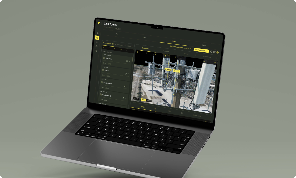
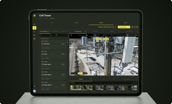
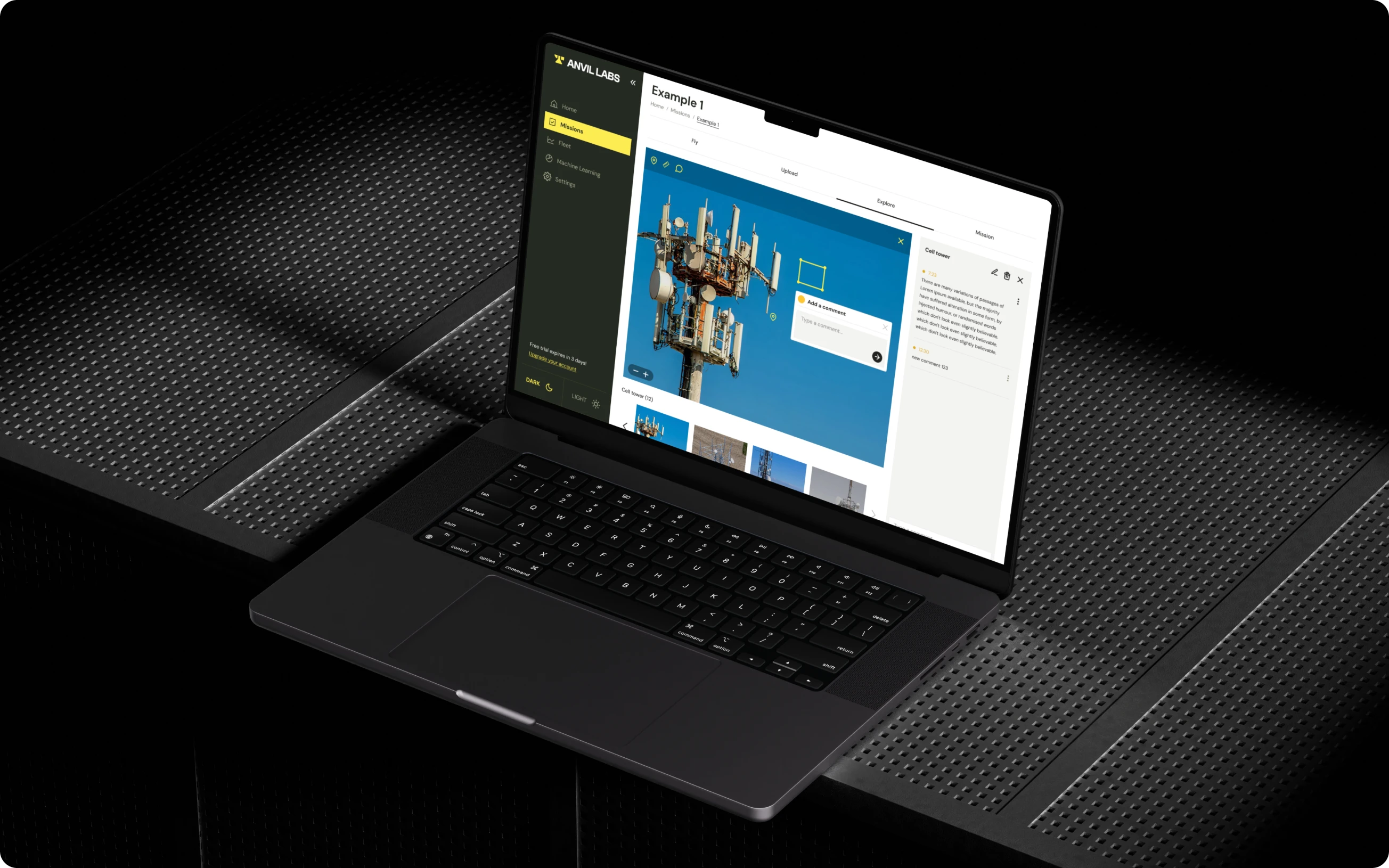
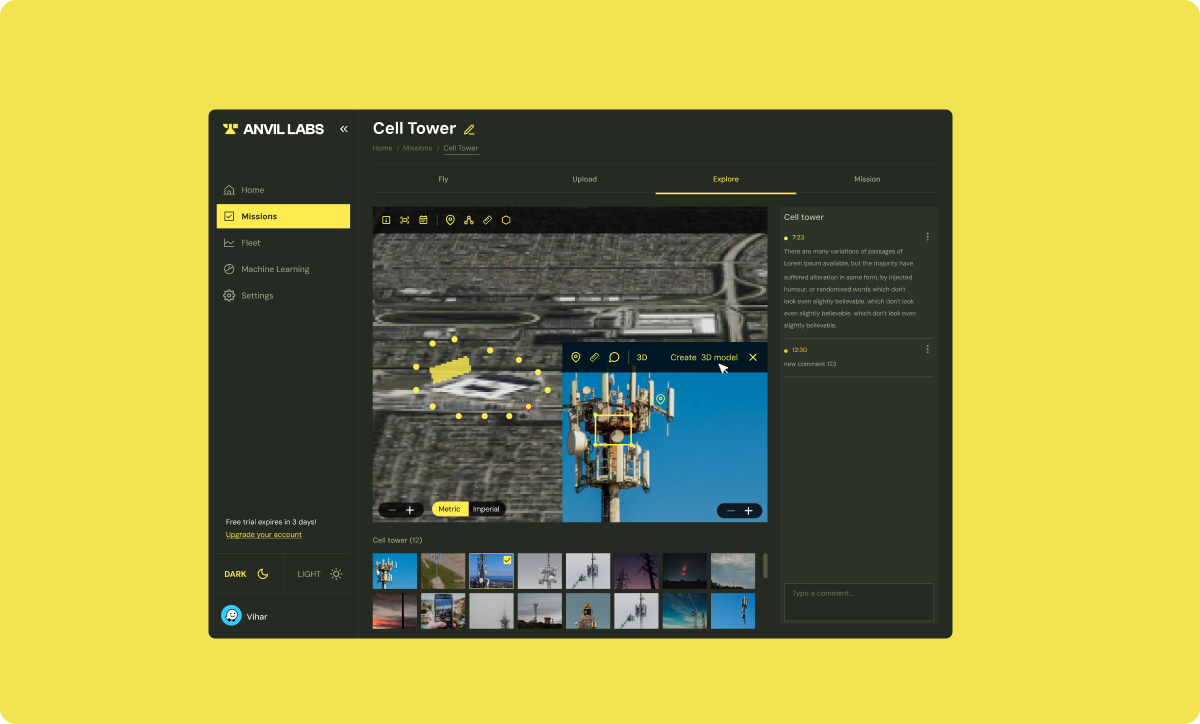
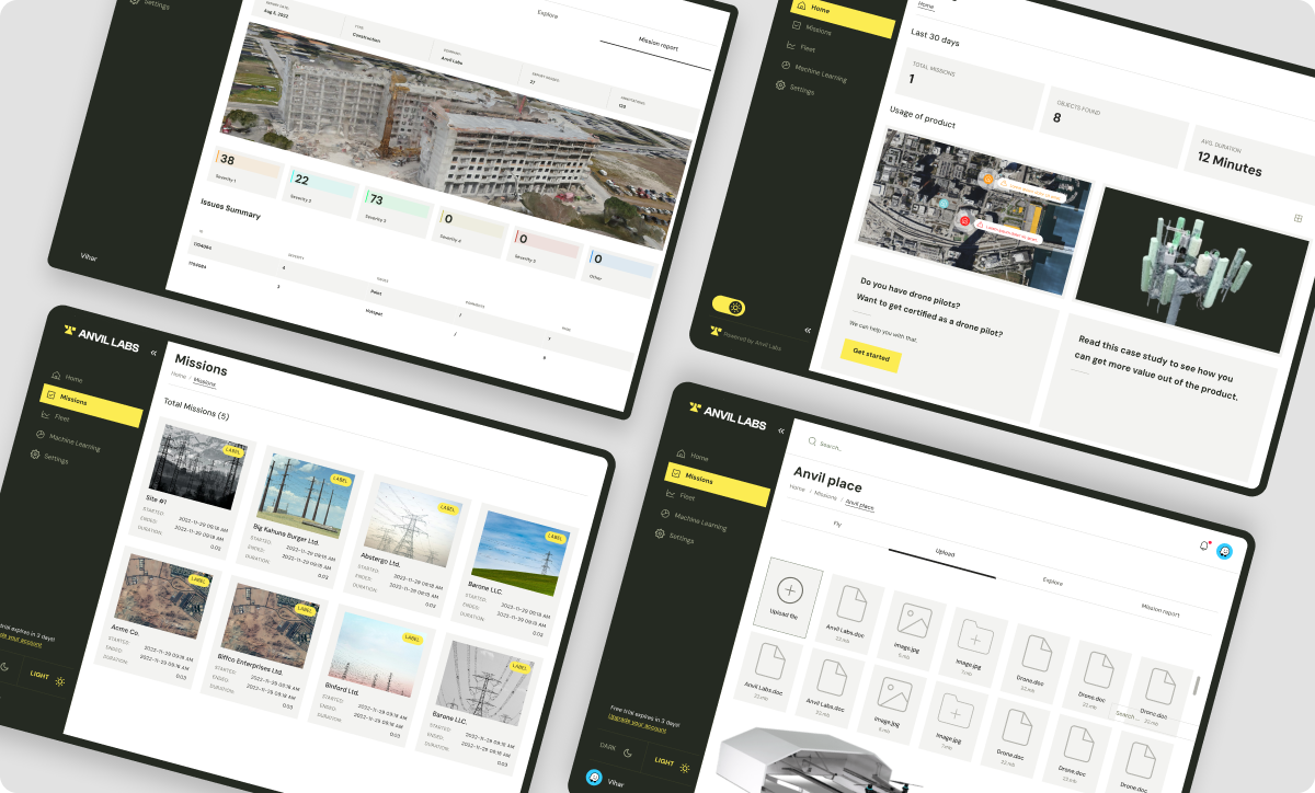
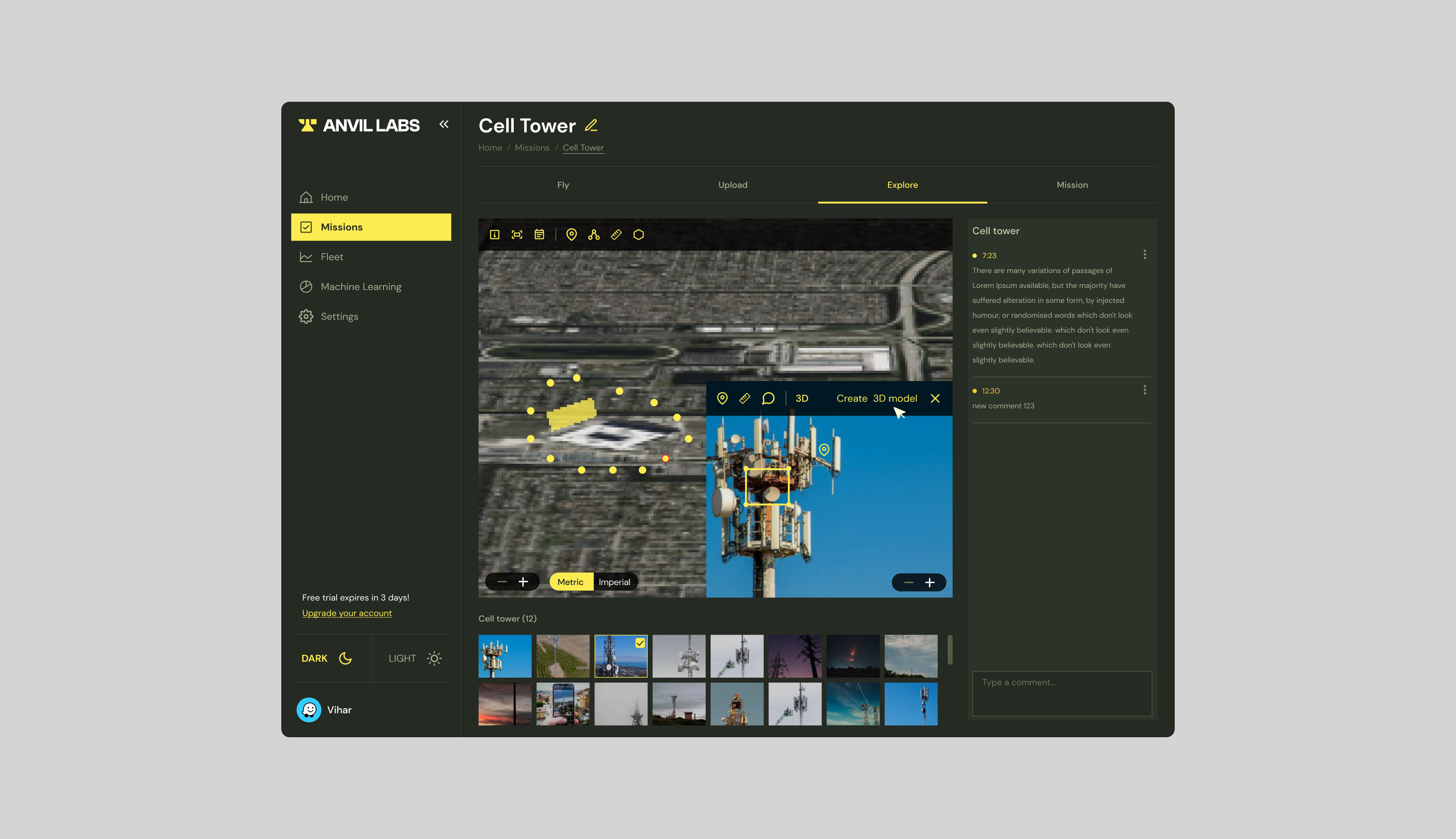
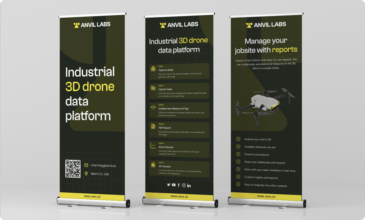
Anvil Labs is an app for managing industrial sites using 3D models, drone-as-a-service solutions, and spatial analytics. Users can plan drone missions, annotate maps, monitor site activity, and generate reports — all from one platform.
Client's problem
The core tension was complexity vs. clarity. Displaying 3D models, map annotations, and live drone footage simultaneously was technically impressive but visually overwhelming — especially on mobile. Touch-based annotation was imprecise, first-time users felt lost, and the feature density made the app feel inaccessible to anyone who wasn't already an expert.
Our solution
We introduced a layer-based UX that let users customize exactly what they saw on screen — hiding or showing data as needed. For mobile, we designed simplified layouts with collapsible menus and gesture-based navigation. Annotation tools were rebuilt with touch accuracy in mind, with zoom functionality for finer control.
Result
A complex, powerful industrial tool that feels clear and accessible — without sacrificing any of the depth that makes it valuable.